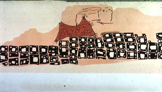
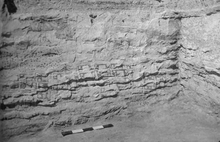
DATE: 6200 B.C.
LOCATION: Museum at Konya, Turkey
DESCRIPTION: In the foreground is a town arising in graded terraces closely packed with rectangular houses. Behind the town an erupting volcano is illustrated, its sides covered with incandescent volcanic bombs rolling down the slopes of the mountain. Others are thrown from the erupting cone above which hovers a cloud of smoke and ashes. The twin cones of the volcano suggest that an eruption of Hasan Dağ, rising to a height of 10.672 feet, and standing at the eastern end of the Konya Plain and visible from Çatalhöyük, is recorded here.
![]()